New England Flooding - Update
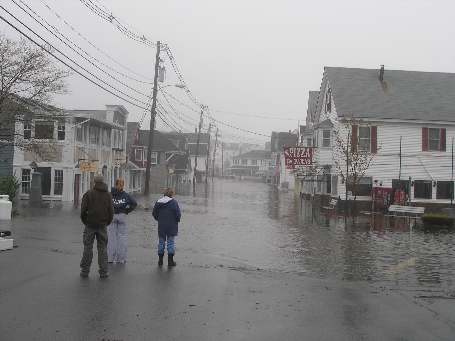
Maine Man's friend has kindly offered the following pictures for us to post, of the flooding this week in York Beach, Maine. (Click on each picture for a bigger picture.)
Just to put things in perspective: York Beach is a tourist town northeast of Portsmouth, N.H., about 90 minutes away from Boston. A place where many head to escape the heat of summer for a few weeks. As such, its economy depends on tourism.
But the tourist season is going to have a rough start.

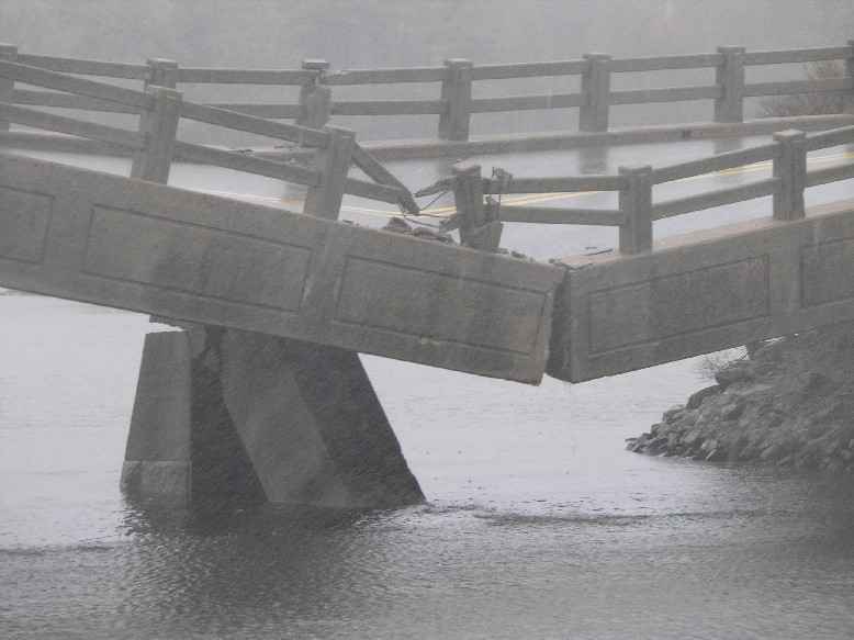
Several local roads were washed out. This is the Cape Neddick bridge, one of the more dramatic failures. The river below displaced the bridge's supports, causing it to buckle. (Now think about how much water it took to generate that kind of force.)

As for the flooding across the region, the rain has let up and the waters are beginning to recede. In Massachusetts, New Hampshire, and Maine, the task is now cleaning up and getting back to normal as quickly as possible.
But this flood has earned a place in the record books:
It really was a 100-year flood.
Preliminary estimates of the magnitude of this week's flooding show the highest-ever floods recorded at 12 rivers in central and southern New Hampshire, the U.S. Geological Survey said Thursday.
Those rivers include the Lamprey River at Newmarket; Salmon Falls River at Milton; Cocheco River near Rochester; Exeter River near Brentwood; Soucook River near Concord; Warner River at Davisville; Piscataquog River near Goffstown; Beaver Brook at North Pehlman; and the Spicket River near Methuen, Mass., the survey said.
"Flows during the flood peak for the Lamprey, Exeter, Warner, Soucook, Merrimack and Spicket rivers generally were at or exceeded those peaks that would be expected an average of once in a 100-year period, termed the 100-year return interval," said Kenneth Toppin, a USGS hydrologist.
Examples of recorded peak flood flows highlight the magnitude of the flooding, Toppin said. For example, the peak flow in the Lamprey River at Newmarket was 9,100 cubic feet per second on May 16; normal flow for this date is 366 cubic feet per second. The Piscataquog River near Goffstown had a peak flow of 10,100 cubic feet per second on May 14; normal flow for this date is 426 cubic feet per second.
The Merrimack River at Manchester peaked at 74,800 cubic feet per second, the third-highest flow since peaks in 1936 from spring runoff and in 1938 from a hurricane.
posted by Tyler @ 9:05 AM
0 comments
![]()


0 Comments:
Post a Comment
<< Home